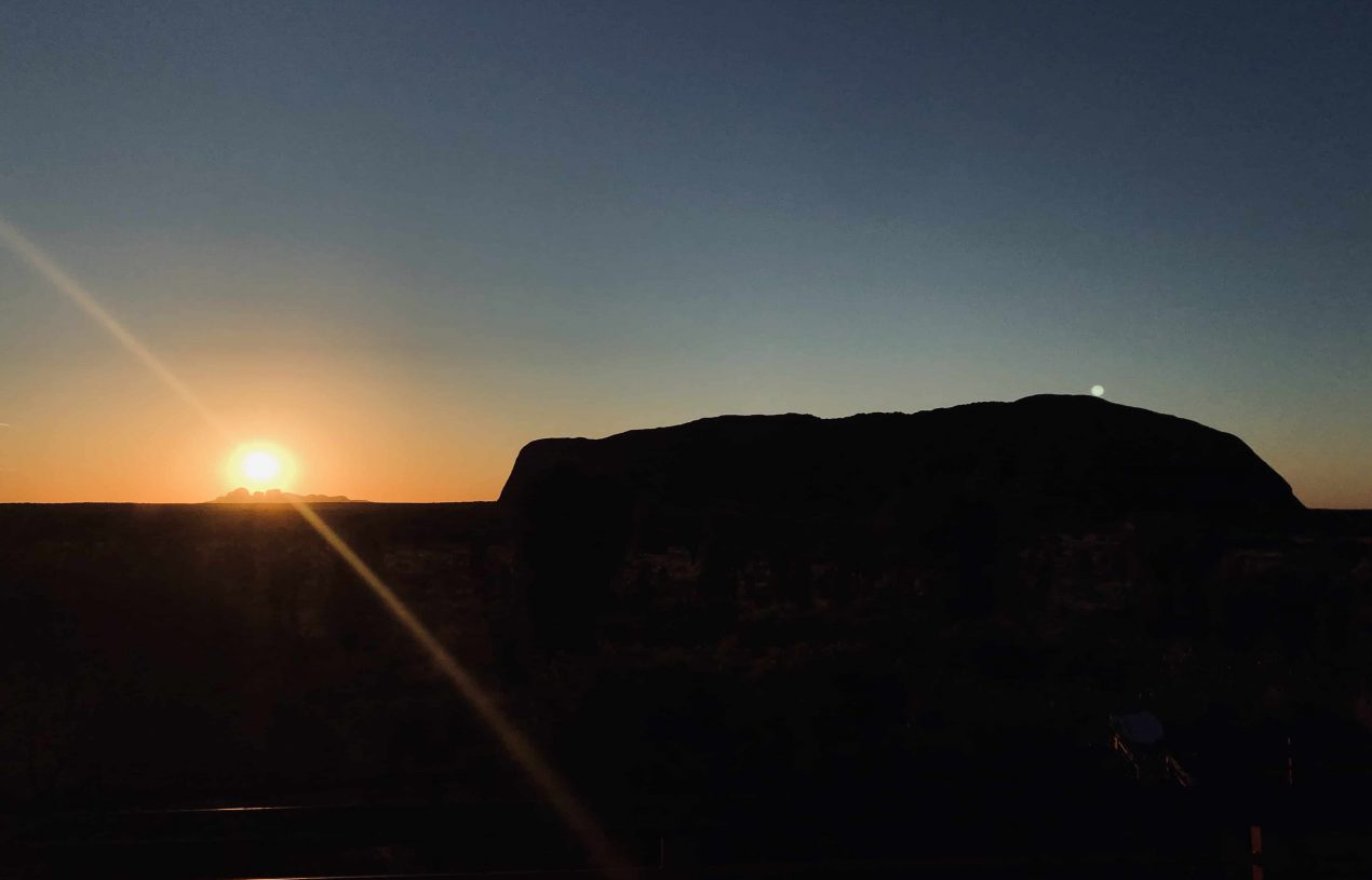
I still remember the first time I visited the rock, there was a strange feeling about it. I was totally in awe and wondering how it was formed. On top of that, I feel like these two big rocks have some sort of magnet that became icons of Australia that have been attracting so many tourists from all over the world. Let’s talk about some geographic history, shall we?
In present day, Uluru and Kata Tjuta are located in two different places and the distance between those two is 58 Km. But did you know that those two famous rocks once part of a sole mountain range, called Petermann Range? Yep, Petermann Range was formed 550 million years ago and spanned 200 Km in length across the Australia continent and reaching as high as Himalayan mountain range.

A shallow sea called Amadeus Basin was formed 950 million years ago and it had sediments that required to merge and form monoliths. As the time passed by, one monolith was blocked off from the sea, evaporated, and became crusted salt. The other one sediments were crumpled, buckled and finally Petermann Range was formed after 400 million years of process. No other types of life survived at that time but algae and bacteria that also helped to break down the mountain range.
500 million years ago, a shallow sea covered the region again and erode Petermann Range since there were no plants alive yet to stabilize the soil. Limestone, mud, and sand fell to the bottom of the sea. The weight of seabed turned those become rock. The rocky part became conglomerate rock (which will be Kata Tjuta) and the sand part became sandstone (we call it Uluru in the future).
400 million years ago, the sea had disappeared. Uluru and Kata Tjuta were so much down and under so much pressure that finally made the sediments into rocks. And during this time, the whole Central Australia began to be the subject to massive force that made some rocks folded and tilted from the horizontal. The rocky fan tilted about 15-20 degrees yet the sand fan tilted about 90 degrees, giving Uluru the look that it has today.

100 million years later, the area dried up and the two structures resurfaced upon the earth and they went through a looooong phase of erosion that shaped each of them as Uluru and Kata Tjuta that we see in present time.

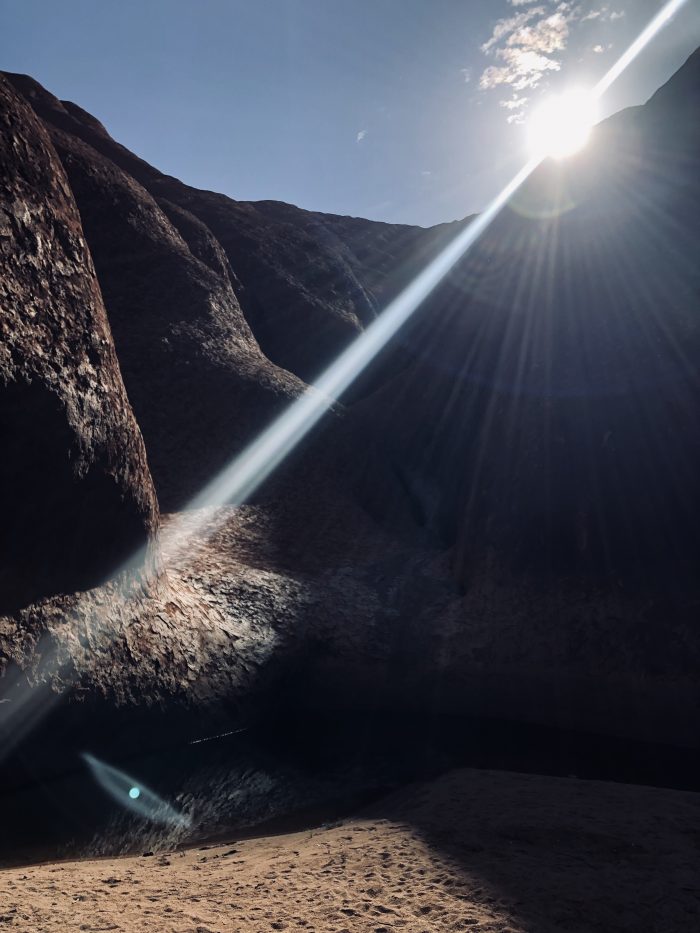
Do you also like the color? I love it so much. The red color of Uluru is due to oxidation or the rusting of iron-bearing minerals within the rock. Actually, the Uluru that we see is just like an iceberg, it still has a massive invisible part underneath.

Anangu people are basically the locals here. From what I read, Anangu people belong to the oldest culture known to a man dating back 60.000 years ago. To Anangu people, Uluru and Kata Tjuta are said to provide evidence of ancient events; the travels of great ancient beings back in the beginning of time. Uluru and Kata Tjuta have been used for traditional ceremonies and rites of passage for over 10.000 years.
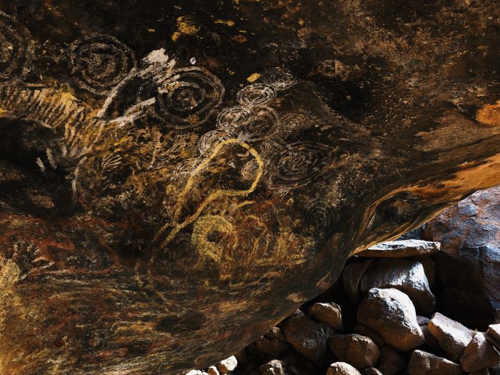
There are also so many caves in Uluru that provided homes to the ancient people, or as community kitchen, and many other purposes. There are also some sacred parts of the rock that prohibit us to take pictures. Well, there’s no CCTV there but if you have a chance to visit, just please abide the law.
The rock has now officially closed for climbing. The numbers of guest has been dropping (maybe also because it’s so damn hot over here during summer). Maybe people found less reason to come, especially those who want to conquer the rock. But so what? The rock doesn’t care. Only those who deserve to enjoy its beauty will enjoy its beauty.